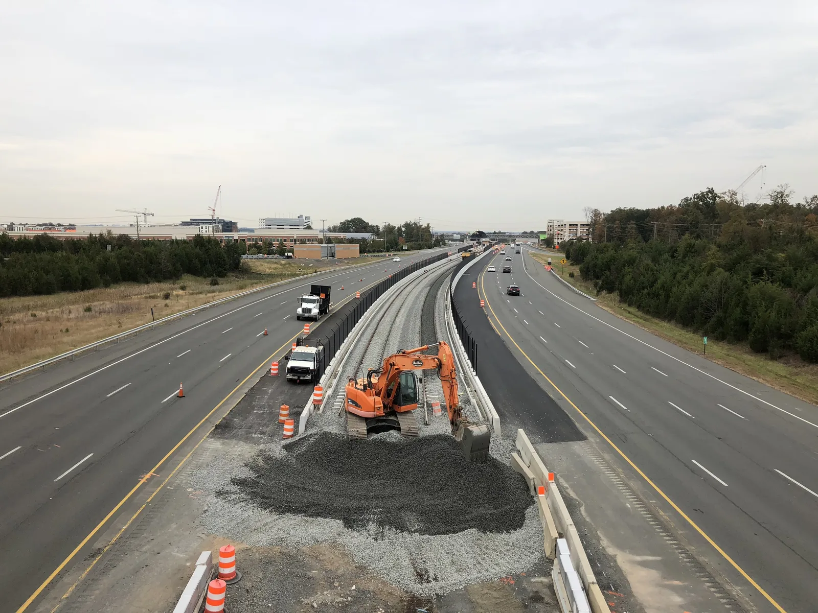
Moorefield Station, at the Ashburn Metro stop, has 6,123 residents and 3,310 more homes approved. All of it is zoned for Rock Ridge High.
Last checked Oct. 19, 2026. The boundary is the U.S. Census Bureau’s Moorefield census-designated place (TIGERweb); people and homes come from the Census Bureau’s 2020-2024 American Community Survey (data.census.gov) and Loudoun County’s Residential Communities layer (July 1, 2025); planning policy is the county’s 2019 General Plan, Chapter 2 and its Policy Areas layer; school zones are the county’s 2026-27 elementary, middle and high school zone layers; ratings are the Virginia Department of Education’s School Quality Profiles; home values are the Zillow Home Value Index (Zillow Research); buses are Loudoun County Transit’s GTFS feed (Sept. 27, 2026); parks, stores and road distances come from OpenStreetMap (© OpenStreetMap contributors) and county park pages.
Moorefield Station is the new neighborhood on the south side of the Ashburn Metro station, where the Silver Line ends. The Census Bureau counts it as the Moorefield census-designated place: 1.1 square miles and 6,123 residents, with Ashburn addresses in ZIP code 20148. Every county address point in it lies inside the county’s Urban Policy Area around the station, the area the 2019 General Plan calls “the highest priority growth areas in the County.”
What this means for you
- Zoned high school: Rock Ridge High, 43460 Loudoun Reserve Drive (every address)
- Typical home value, ZIP 20148: $869,300 in September 2026, according to Zillow; the Census median home value for Moorefield is $800,200
- Nearest Dulles Greenway exit: Exit 7 (Loudoun County Parkway), about 2.2 miles by road; the Ashburn Metro station is about 2.3 miles from the middle
- Construction ahead: 3,310 more homes are approved here, the county says
Where it is
The Census place runs south from the Dulles Greenway and the Silver Line, with Loudoun County Parkway along its eastern side. Inside, the main streets are Old Ryan Road, Moorefield Boulevard, Claude Moore Drive, Centergate Drive, Metro Center Drive and Mooreview Parkway. Broadlands is to the northwest, Brambleton to the west and Loudoun Valley Estates to the south. Across the tracks, inside the Census Bureau’s Ashburn boundary, is Loudoun Station, which the county counts at 675 apartments with 249 more approved.
What the county plans here
The General Plan describes the station areas as “transit-oriented communities with a dense urban core” and says the Ashburn and Loudoun Gateway stations “will serve as transit and commuter hubs while providing an urban walkable environment.” It calls for connected street grids with sidewalks, short blocks and trail links to the neighborhoods around them. Expect construction near the station for years.
Homes and people
Loudoun County’s Residential Communities layer places these inside the Census place, as of July 1, 2025:
| Community | Single-family | Townhouses | Condos and apartments | Approved, not yet built |
|---|---|---|---|---|
| Moorefield Station | 55 | 1,300 | 1,340 | 3,310 |
| Dulles Parkway Center | 0 | 124 | 0 | 0 |
Townhouses and apartments make up almost all of it. The Census Bureau’s 2020-2024 American Community Survey counts 2,205 households, 1,357 of them, or 62%, in owner-occupied homes, and a median home value of $800,200. Census figures for a place this new are survey estimates with wide margins.
Schools
Every one of the 2,041 county address points in the Census place is zoned for the same three schools for 2026-27:
| School | Grades | Address | State rating |
|---|---|---|---|
| Moorefield Station Elementary | K-5 | 22325 Mooreview Parkway | Meets Expectations |
| Stone Hill Middle | 6-8 | 23415 Evergreen Ridge Drive | Distinguished |
| Rock Ridge High | 9-12 | 43460 Loudoun Reserve Drive | Distinguished |
Moorefield Station Elementary is inside the Census place. The rating is the school’s level in Virginia’s School Performance and Support Framework; all three are Fully Accredited for 2025-26. Check one address in the LCPS LABEL lookup and see our schools guide.
Home values
Zillow’s Home Value Index for ZIP 20148 was $869,300 in September 2026, up 0.4% from $865,482 in September 2025, according to Zillow’s ZIP code file. Zillow’s figure for all of Ashburn was $795,910, up 0.5%. ZIP 20148 also covers Broadlands, Brambleton and Loudoun Valley Estates, where single-family houses are a much larger share of homes, so it is a loose guide for Moorefield’s townhouses and condos. The index is a modeled typical value, not a sale price. See our home prices guide.
Parks and trails
- Moorefield Community Park, 43240 Clarendon Square: a county community park.
- Moorefield Green Community Park, 22523 Naugatuck Square, and Woodlyn Park on Cambridgeport Square, both inside the Census place on OpenStreetMap.
- Lyndora Park, 43624 Lucketts Bridge Circle, just south in Loudoun Valley Estates.
VDOT is building new paths to the Ashburn station; see our road construction guide and parks and trails guide.
Getting around
Distances are measured on the road network from the middle of the Census place (OSRM routing on OpenStreetMap data); they are not drive times.
| To | Distance |
|---|---|
| Dulles Greenway Exit 7 (Loudoun County Parkway) | about 2.2 miles |
| Ashburn Metro station (Silver Line) | about 2.3 miles |
| One Loudoun | about 6.4 miles |
| Washington Dulles International Airport | about 6.7 miles |
Trains run east from Ashburn toward Washington. The county’s Ashburn South garage, 43625 Croson Lane, has a kiss-and-ride and a bus stop. Loudoun County Transit’s GTFS data show fare-free Route 371 (Moorefield) with seven stops inside, plus stops on Routes 372, 373, 374, 375, 351 and 391. Garage and fare details are in our getting around guide.
Groceries and everyday stores
OpenStreetMap lists no supermarket inside the Census place. The nearest are Harris Teeter, 43300 Southern Walk Plaza, and Walgreens, 43250 Southern Walk Plaza, both in Broadlands, under a mile from the middle.
How to check an address
Search the parcel on Loudoun County’s WebLogis map for zoning, the assessed value and nearby approved projects, then check the schools in LABEL. Real estate tax is billed by Loudoun County; see our property tax guide. All 10 areas are on our Ashburn neighborhoods guide.
Frequently asked questions
What schools serve Moorefield Station?
For 2026-27, every county address point in the Moorefield Census place is zoned for Moorefield Station Elementary, 22325 Mooreview Parkway, Stone Hill Middle and Rock Ridge High.
How far is Moorefield Station from the Ashburn Metro station?
The Census place reaches the station on its northern side; from its middle, the station is about 2.3 miles by road. Fare-free Loudoun County Transit Route 371 has seven stops inside it.
Is Moorefield Station still being built?
Yes. Loudoun County counts 2,695 homes built in the Moorefield Station community and 3,310 more approved but not yet built, as of July 1, 2025.
Is Moorefield Station a good place to live?
That depends on the household. The facts: Moorefield Station is a 1.1-square-mile Census place of 6,123 residents next to the Ashburn Metro station, with three neighborhood parks and its own elementary school. Zillow’s typical value for ZIP 20148 was $869,300 in September 2026.
Have your say